This information came from the Muhlenberg, Kentucky Historical Society. All rights and credit should go to them.
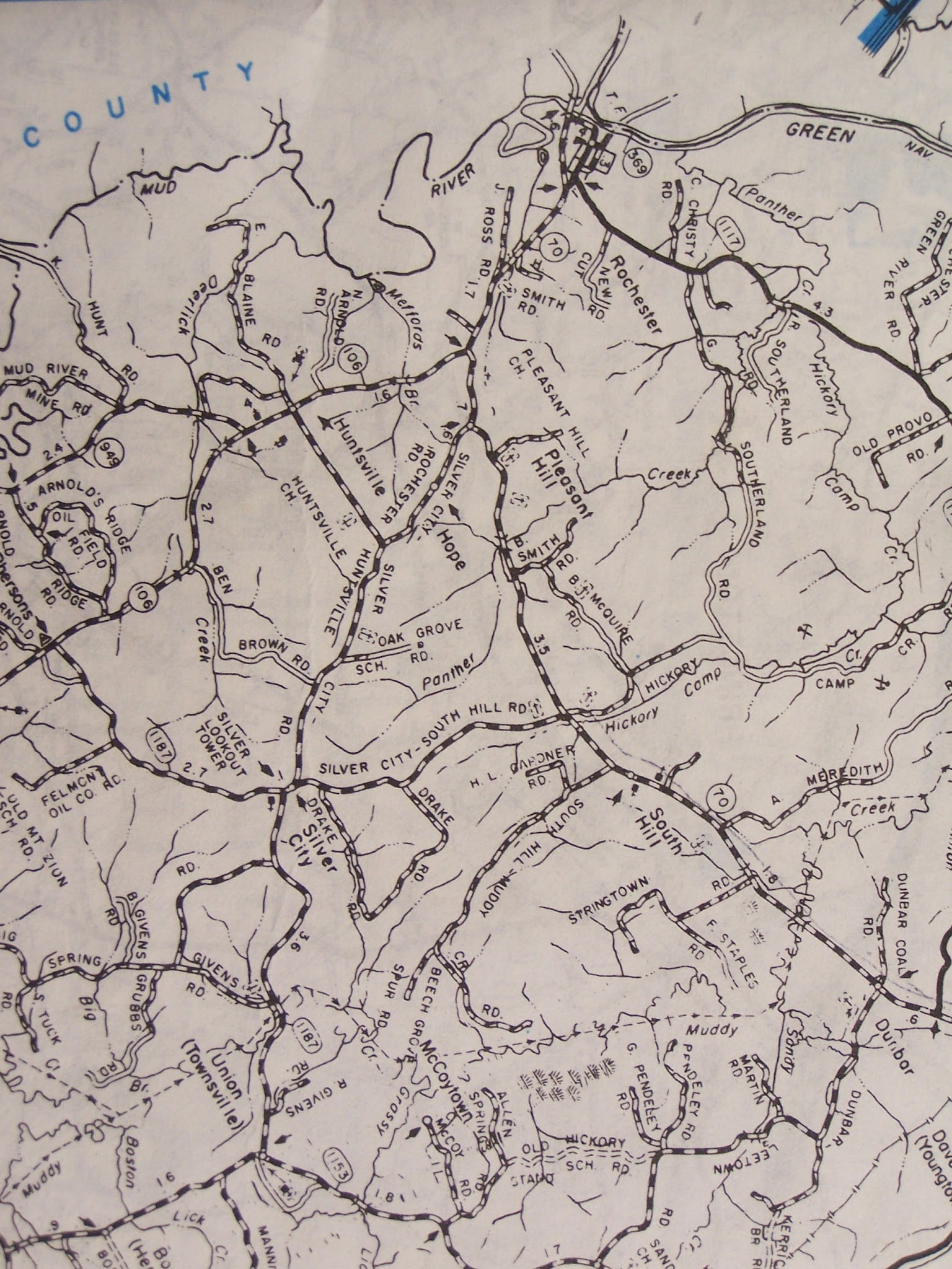
I'm still looking for the key to the map.
Info from my notes:
CRAIG Cemetery:
Located East of Highway 181 nearintersection of Highway 890 on a count road where Claud Duvall now lives and closer to the old Yont's farm where the road dead-ends. Copied April 25, 1971.
Davis Cemetery:
West of Highway 181 on Louis R McGee farm.
Copied May 27, 1972
Johnston Cemetery:
Located about 1 mile East of Highway 181 at Tooley HIll. Take gravel road East near top of hill. Copied May27, 1972.
I'm interested in Hunts, Welbornes, Newman, and Rhodes, so there is a really good chance that those are the ones marked in red.
Newman Cemetery:
Located on Blake fram on Highway 431 near Penrod K. All stones are down with cattle running over them. Copied June 3, 1973.
Newman Cemetery:
Located about 2 miles East of Highway 181 on Carters Creek road, on left side, going across cattle guard & around bend on right. Copied June 3, 1972. This is the Newman Cemetery pictured in "Rothert's History of Muhlenberg County KY".
Map for Hope Cemetery, Muhlenberg, Kentucky.
Map for Hebron, Muhlenberg, Kentucky.
Map for Penrod, Muhlenberg, Kentucky.
Map for Wells, Muhlenberg, Kentucky.
Map for Hazel Creek, Muhlenberg, Kentucky.